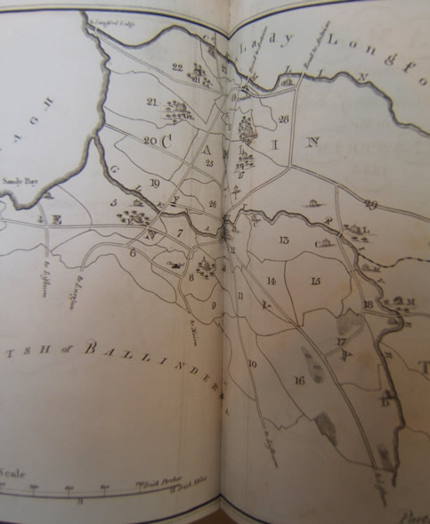
The following maps are photographs of the map published in “A Statistical Account Or Parochial Survey Of Ireland”, Drawn up from the communications of the clergy By William Shaw Mason, Esq. M.R.I.A. Remembrancer and receiver of First Fruits, and Secretary to the Board of Public Records, Volume 2, 1816, of Glenavy, Camlin and Tullyrusk, No. XIII, Parishes of Glenavy, Camlin and Tullyrusk (Diocese of Connor, and County of Antrim) By the Rev. Edward Cupples, L.L.B. Vicar
Complete Map

Map 1 – Maps from “A Statistical Account or Parochial Survey of Ireland”
Close-up of Left Section of Map

Map 2 – Maps from “A Statistical Account or Parochial Survey of Ireland”
Close-up of Middle Section of Map

Map 3 – Maps from “A Statistical Account or Parochial Survey of Ireland”
Close-up of Right Section of Map

Map 4 – Maps from “A Statistical Account or Parochial Survey of Ireland”
